Thursday, September 5, 2013

Kelly Butte Trail and Lookout Tower


  I recently read about Kelly Butte Trail and Lookout (roughly 45 miles south/SE of Enumclaw,WA) from a trip report on the Washington Trails Association website, never hearing about this location prior to reading, The trip report indicated that staying at the lookout tower itself was possible as long as one were to bring a screwdriver to open the dormers. But, to not avail as the door was locked. As my brother and I were heading up on the trail, I struck up a conversation to a passing backpacker about the area. He was full of knowledge about the hike, locating a perfect place to place a tent, the lookout and surrounding area. He indicated that it was possible to stay in the Lookout if one was to contact the ranger's station in Enumclaw prior to a visit. We did not do this but I did bring my tent as backup.
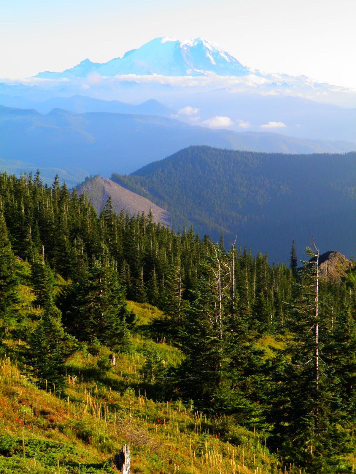
  The views at the top were spectacular. 360 degree views of everything in site including nearby Mt. Rainier and the city lights of Seattle to the north as dark enters the evening sky. A beautiful night sky greeted us as the Milky Way and shooting stars were out in all of their glory. We stayed at the Lookout admiring the amazing beauty from sunset to darkness for a  good hour eating our meal and freeze-dried ice cream that was delicious. We eventually went back to the tent about a 100 yards from the Lookout nestled below the ridge about 30 feet which kept us out of the wind and left us nice and warm for the night.
  Not wanting to miss sunrise with views that were not meant to left by their lonesome, I arose early enough to make sure that I could get my brother up as well to see such a splendid beauty of colors over a bed of clouds that sat below the surrounding mountain tops. Breathtaking.
  A quick but great trip with my brother. I would recommend this trip to anyone, especially if time is limited and you want to get away from it all.

Kelly Butte (#1031)
South Cascades -- Chinook Pass - Enumclaw or Hwy 410 area                            
Roundtrip3.4 miles
Elevation Gain900 ft
Highest Point5409 ft

Driving Directions:   About two miles past Greenwater, turn left from Highway 410 onto paved Forest Road 70. All mileage readings are from this junction.
  At 8 miles, turn left onto a road signed 7030 and an arrow. There is about 10 feet of pavement, then gravel. This section of 7030 has some washboard driving surface.
  At 8.3 miles cross a bridge and pass some campsites.
  At 11.9 miles, come to a T and turn left, staying on unsigned 7030. (A right turn will take you toward Colhoquon and Pyramid Peak and PCT trailheads.) The rest of 7030 has a couple of steep sections and falling rock areas.
  At 12.4 miles go straight, not right and uphill.
  At 13.1 miles turn right. At this time there is a sign that indicates that the road to the right is 7030; the road straight ahead is signed 7032.
  Pass side roads at 13.6 and 14.1 miles.
  The rough road to the Kelly Butte “trailhead” is on your left at 14.4 miles from Highway 410


Thursday, June 13, 2013

Mt. Teneriffe-Kamikaze Falls June 9, 2013


   A return trip to Mt. Teneriffe and Kamikaze Falls was in order, since the first time and last time I attempted this hike last fall I was got caught in a thunder storm half way up to the falls. At the time, I pushed a little further than I should have and got as far as the lower falls, about 1/4 mile short of the main falls. However, I knew I could come back on a nicer day and not be struck by lightning in the process.
  Mt. Teneriffe which is the lesser known and less used area than the local icon, Mt. Si is a terrific and in my opinion a nicer hike than Si or Little Si. Yes, the dramatic views from Mt. Si 's Haystack is one that can be of epic proportions. However, sharing this view with too many other people at the same time takes away from one of the reasons I like to go on hikes, to get away from it all and the people that go along with it all.
  Today, I was in no hurry to either get to the falls or to get back down so Lucy and I took our time the entire way. Starting at 12:00, we headed up via an old logging road  that connects to the back side of Mt. Si. At the 1 mile point we turned off the road and got onto an even older logging road that eventually gave us some nice views of the valley below. After another mile we got onto the single track boot trail off to our right with signage informing us another mile to Teneriffe Falls (not sure why it is renamed). We took several detours along the way to get a better views of the stream and smaller falls that would otherwise be hidden from the main trail. There are some side trails going up as well as an old trail that assume ran along with the stream to Kamikaze Falls that would have been more intense than the newer trail, would have offered better and more frequent views the stream but would not have offered up fantastic panoramic views of the valley and surrounding mountains of the new trail.  Around 2 pm we arrived at Kamikaze Falls. Stunning.  
  Lucy and I stayed for about 1/2 hour until more and more people started to show up (seemed like a parade), the peacefulness of the surrounding waterfall and stream just left the area, as did us. On the way down, I spotted the old trail and followed it for a spell, getting great views of the stream and lower falls. Since, I wasn't certain where this trail would eventually end up, we connected and stayed on the newer trail to the end. 
  Lucy and I arrived back at the trailhead at 4 pm. Using my cell phone GPS we traveled about 5.5 miles. Although, the trail guides I looked at stated the round trip to Kamikaze Falls at 6 miles.
  I would definitely head back to try this hike out again but I would do some more research and try using the old trail along with going to the summit of Mt. Teneriffe. Another possibility would be to use a little used trail going from the summit of Mt. Teneriffe over to the summit of Mt. Si...that would be great!
  *For some reason, I couldn't enlarge some of the photos below. My apologies.* 
From the trail looking at the backside of Mt. Si?
My date, Ms. Lucy posing so elegantly...and patiently.

A look up...
 
 One of the smaller cascades off the trail...
 
 Middle portion of Kamikaze Falls...

Views of Kamikaze Falls...

The falls and I...
 

Heading down on the old trail and finding some new scenery.
 

Lucy and I enjoying the views together...
 

Views from the new trail...The valley below along the mountains on the other side of I-90.

Very peaceful.

A nicely shaped fern along the trail...
 

Some foxglove along the trail...

A nice lady offered to take our picture together!
Thank-you :-)